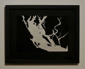
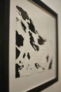
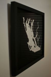
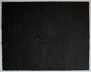
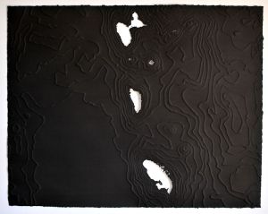
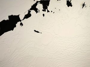
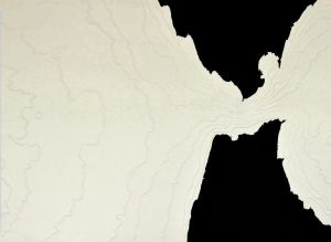
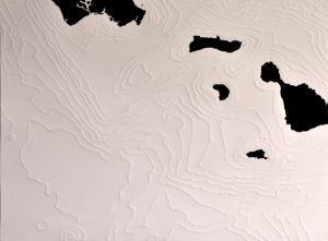
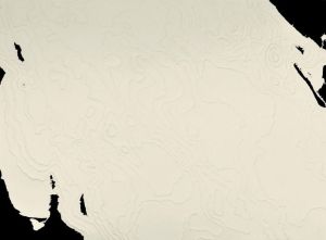
These drawings depict specific locations in the ocean that attract high concentrations of whales. Drawn in the reverse of conventional maps I invert water and land forms showing details of the underwater terrain while landforms are depicted as simple, black shapes: negative space from a whale’s perspective.
“It is not down on any map; true places never are.” ― Herman Melville
-

- 123.196°, 48.758° (Strait of Georgia), 12.5″ x 15.75″, gouache on embossed paper, 2017
-
- 124.654°, 49.838° (The Salish Sea), gouache on embossed paper
-

- 123.564°, 48.946° (Strait of Georgia), gouache on embossed paper
-
- 123.196°, 48.758° (Strait of Georgia), 12.5″ x 15.75″, gouache on embossed paper, 2017
-
- 124.654, 49.838 (The Salish Sea), 12.5″ x 15.75″, gouache on embossed paper, 2017
-

- 123.564°, 48.946° (Strait of Georgia), 15.75″ x 12.5″, gouache on embossed paper, 2017
-

- 123.196°, 48.758° (Strait of Georgia), 12.5″ x 15.75″, gouache on embossed paper, 2017
-

- 124.654°, 49.838° (The Salish Sea), 12.5″ x 15.75″, gouache on embossed paper, 2017
-

- 123.564°, 48.946° (Strait of Georgia), 15.75″ x 12.5″, gouache on embossed paper, 2017
-
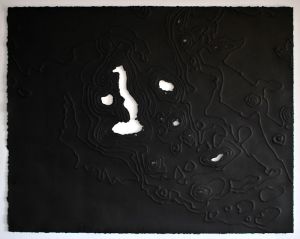
- -90.620, -0.757 (Galapagos), 22″ x 28″, India ink on embossed paper, 2016
-
- 73.299, 0.525 (Maldives), 22″ x 28″, India ink on embossed paper, 2016
-
- -61.339, 15.447 (Dominica), 22″ x 28″, India ink on embossed paper
-
- Bering Sea: -161.411°, 54.795°, 22″x30″, gouache on embossed paper, 2015 (sold)
-
- Mediterranean Sea: -6.182°, 35.912°, 22″x30″, gouache and embossed paper, 2016
-
- -161.411°, 54.795° , 22″x30″,gouche on paper, 2016 (sold)
-
- Sea of Cortez: -109.382°, 24.852°, 22″x30″, gouache and embossed paper, 2016 (sold)
-
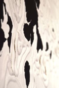
- Bering Sea: -161.411°, 54.795°, detail, gouache on embossed paper, 2015
-
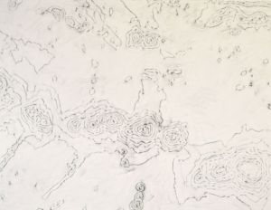
- -162.163°, 23.096° (West), 20″x26″, graphite on paper, 2015
-
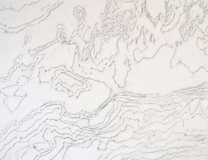
- 161.411°, 54.795° (North), 20″x26″, graphite on paper, 2015
-
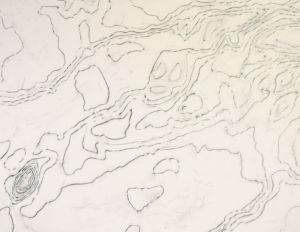
- -53.382°, -60.673°(South), 20″x26″, graphite on paper, 2015
-
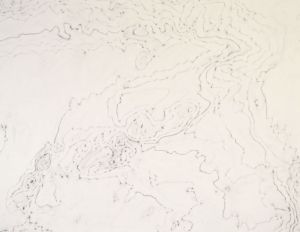
- 63.529°, 25.380° (East), 20″x26″, graphite on paper, 2015
